

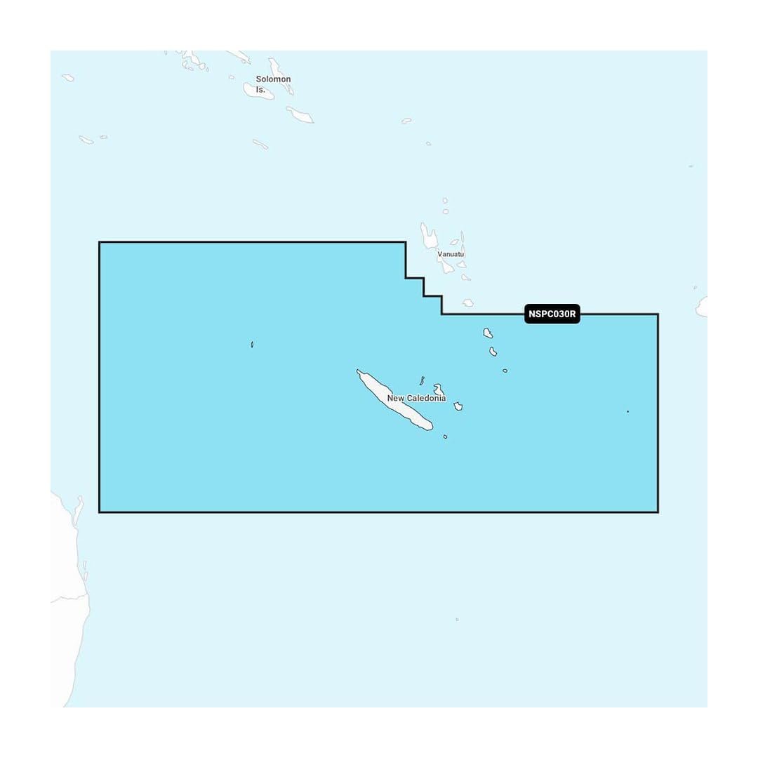
Shop Garmin Navionics+ New Caledonia chart card featuring detailed coastal charts, reef mapping, and downloadable updates.
25 in stock
25 in stock

The Garmin Navionics+ New Caledonia Chart Card provides detailed marine chart coverage for coastal waters, reefs, harbors, and surrounding navigation areas throughout New Caledonia. Designed for Garmin chartplotters, the chart package supports safe and efficient marine navigation. || Navionics+ cartography includes shoreline detail, navigation aids, depth contours, and Auto Guidance+ functionality on supported Garmin devices. Downloadable updates help maintain current chart information and navigation accuracy. || Ideal for sailors, anglers, cruisers, and recreational boaters, this chart card delivers valuable navigation resources for exploring the waters of New Caledonia.
| Brand | Garmin |
|---|---|
| Model | Navionics+ New Caledonia |
| MPN | 010-C1284-20 |
| Product Type | Marine Chart Card |
| Material | MicroSD Card |
| Finish Color | Black |
| Dimensions | MicroSD Format |
| Weight (lb) | Not Published |
| Load Capacity | Not Applicable |
| Drawer Count | Not Applicable |
| Drawer Type | Not Applicable |
| Lock Type | Not Applicable |
| Mount Type | Chartplotter Slot |
| Installation | Plug In |
| Compatibility | Garmin Chartplotters |
| Use Case | Marine Navigation |
| Warranty | 1 Year Limited |
| Country of Origin | Not Published |
| Series | Navionics+ |
| UPC | 753759289782 |

© 2026 Sports and Wheels

Reviews
There are no reviews yet.