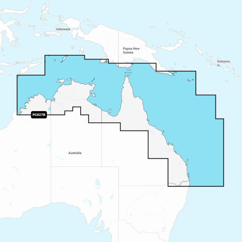
Discover Garmin NSPC027R charts with Great Barrier Reef coverage, Brisbane routing and one-year updates for compatible Garmin chartplotters.
24 in stock
24 in stock



The Garmin Navionics+ NSPC027R marine chart card provides detailed inland and coastal chart coverage for northeastern Australia on a microSD/SD card compatible with Garmin chartplotters. Coverage stretches from Wolcott Inlet to Brisbane and the Gold Coast and includes major navigation areas such as Darwin, Cairns, the Great Barrier Reef and Port Moresby in Papua New Guinea. A one-year subscription to daily updates is included through Garmin’s ActiveCaptain platform. || Designed for offshore fishing, coastal cruising and long-range marine navigation, the NSPC027R chart combines detailed shoreline data with inland waterway information. Advanced depth-shading tools help identify structure and depth contours while updated navigation content supports safer route planning throughout northern and eastern Australian waters. || Garmin Navionics+ mapping features a modernized chart appearance with the widely recognized Navionics color scheme. The chart card installs directly into compatible Garmin multifunction displays and delivers region-specific navigation detail for mariners operating throughout the Coral Sea and surrounding coastal waterways.
| Brand | Garmin |
|---|---|
| Model | NSPC027R |
| MPN | 010-C1281-20 |
| Product Type | Marine Charts |
| Material | Digital Cartography |
| Finish Color | Multi-Color Maps |
| Dimensions | Not Published |
| Weight (lb) | 1 lb |
| Load Capacity | Not Published |
| Drawer Count | Not Published |
| Drawer Type | Not Published |
| Lock Type | Not Published |
| Mount Type | microSD/SD Card |
| Installation | Plug-In Card |
| Compatibility | Garmin Chartplotters |
| Use Case | Marine Navigation |
| Warranty | One-Year Updates |
| Country of Origin | Not Published |
| Series | Navionics+ |
| UPC | 753759289751 |
Deliver in 3-5 business days
30 days return policy
Secure Payment at checkout
We are always here.
© 2026 Sports and Wheels


Reviews
There are no reviews yet.