End of Content.
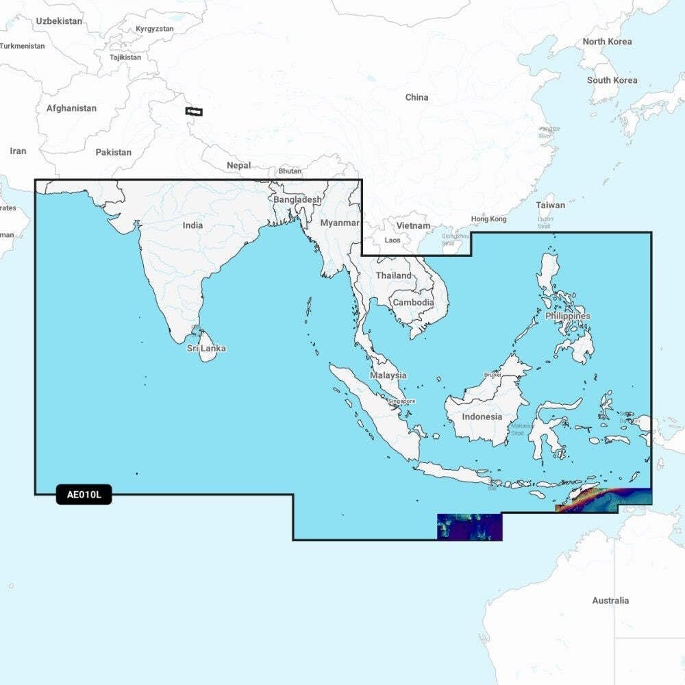
Shop Garmin NVAE010L charts with Indian Ocean and South China Sea coverage, relief shading, 3D views and one-year updates for offshore navigation.
Out of stock



The Garmin Navionics Vision+ NVAE010L marine chart card provides detailed offshore and coastal coverage across the Indian Ocean and South China Sea in a microSD/SD format for compatible Garmin chartplotters. Coverage extends from Gwadar, Pakistan to Da Nang, Vietnam and includes India, Sri Lanka, Bangladesh, Myanmar, Thailand, Malaysia, Singapore, Cambodia, Indonesia, Brunei, the Philippines, the Maldives, the Andaman and Nicobar Islands, Cocos Islands and Christmas Island. Premium features include high-resolution relief shading, satellite imagery, aerial photography and 3D FishEye and MarinerEye perspectives. || Designed for offshore cruisers, commercial operators and sport-fishing vessels, the NVAE010L chart helps improve route planning with Auto Guidance+ technology and customizable depth shading. Daily chart updates are available through the included one-year subscription using the ActiveCaptain app, helping navigators maintain current chart information across busy regional waterways and coastal routes. || Garmin Vision+ cartography combines advanced visualization tools with detailed marine mapping for enhanced situational awareness. Dynamic lake level support, downloadable premium layers and multiple chart display options allow mariners to tailor navigation screens for changing conditions and destination-specific requirements throughout South Asia and Southeast Asia.
| Brand | Garmin |
|---|---|
| Model | NVAE010L |
| MPN | 010-C1213-00 |
| Product Type | Marine Charts |
| Material | Digital Cartography |
| Finish Color | Multi-Color Maps |
| Dimensions | Not Published |
| Weight (lb) | Not Published |
| Load Capacity | Not Published |
| Drawer Count | Not Published |
| Drawer Type | Not Published |
| Lock Type | Not Published |
| Mount Type | microSD/SD Card |
| Installation | Plug-In Card |
| Compatibility | Garmin Chartplotters |
| Use Case | Marine Navigation |
| Warranty | One-Year Updates |
| Country of Origin | Not Published |
| Series | Navionics Vision+ |
| UPC | 753759289874 |
Deliver in 3-5 business days
30 days return policy
Secure Payment at checkout
We are always here.
© 2026 Sports and Wheels


Reviews
There are no reviews yet.